Atlas iZemZ Geospatial Systems produces DSM & DTM from commercial satellite images. We pick the right imagery provider and the right data to reduce your costs while improving the quality of product.
Using our textured models, get realistic views of your area of interest in 3D/4D and deeply understand your environment before decision making process. We provide tiled and no-tiled models from aerial and satellite data.
Automated object extraction from satellite and aerial images, using deep learning techniques. Post-processing and control process to ensure deivery of high quality products.
We exploit the large satellite constellation of our imagery providers and partners to ensure 2D/3D products for any area of interest around the globe.
A light-weight api to automatically process your raw images in parallel architecture, and render high quality 2D/3D/4D products of your AOI.
We design 2D/3D/4D geospatial systems that ensure uploading, processing, sharing and comparing geodata according to your specifications.
 Request Samples
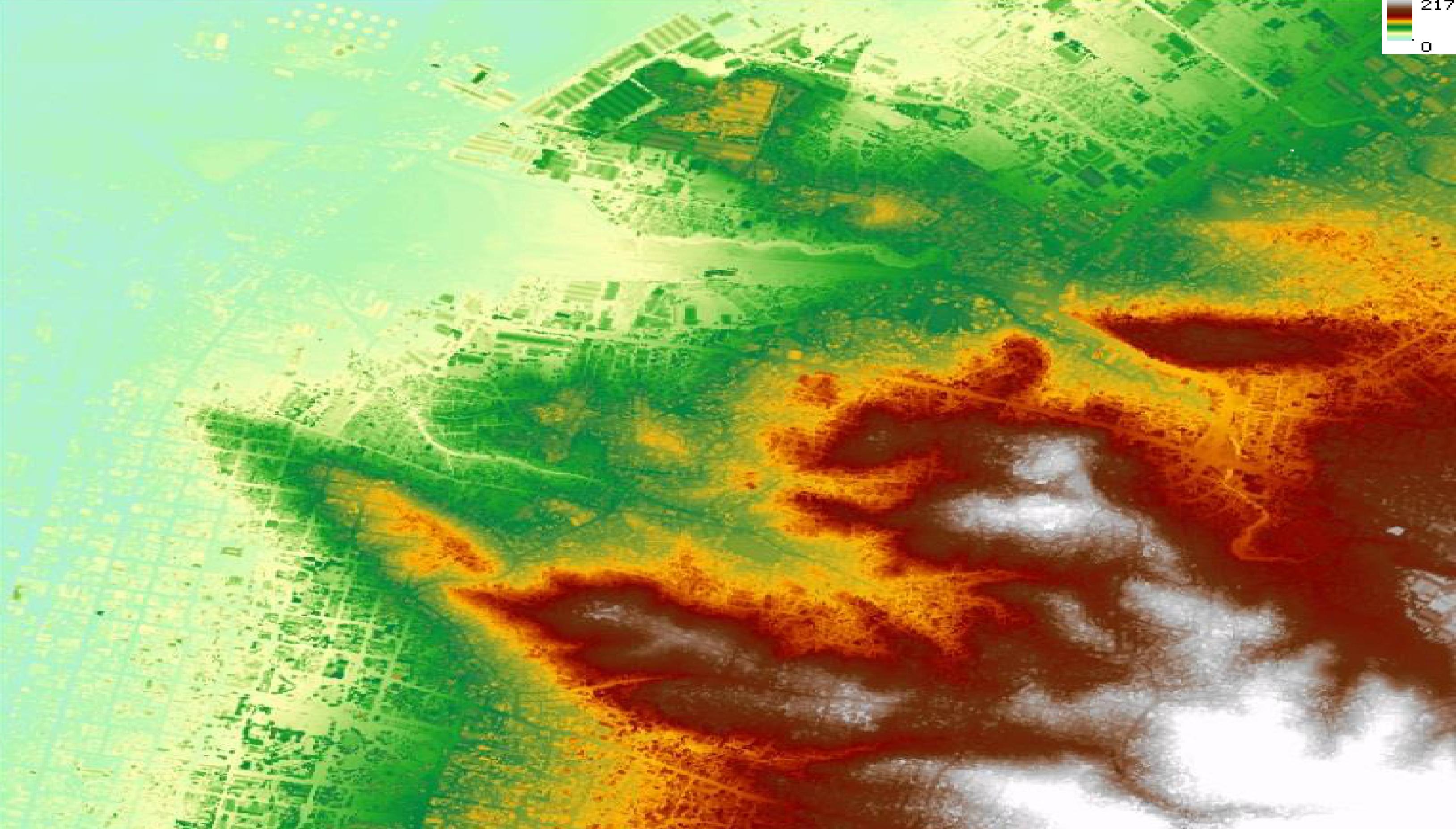
Detailed Elevation Model from stereo or multi stereo satellite and aerial imagery.
Request Samples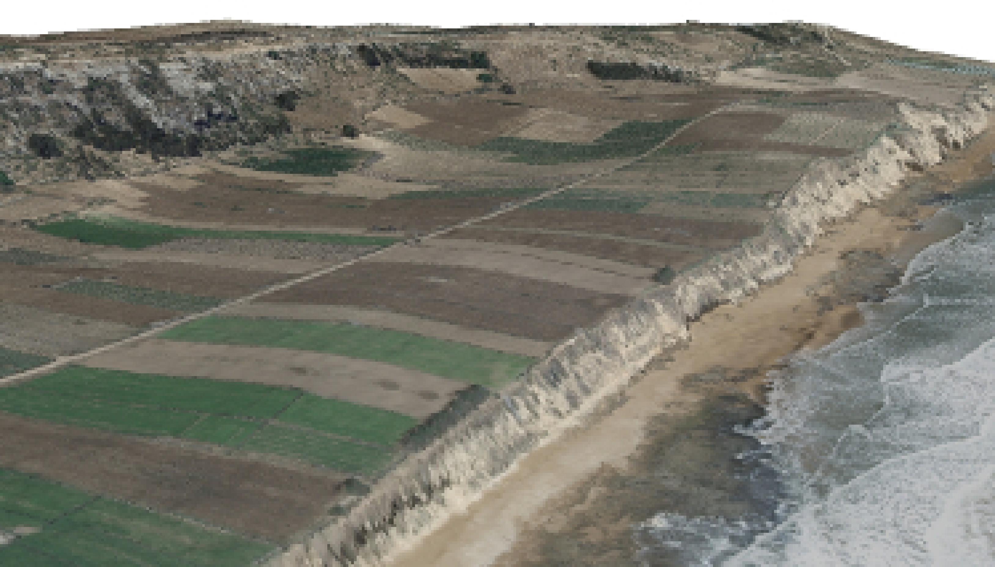 Request Samples
3D representation of an area of interest using tiled or no-tiled models
Request Samples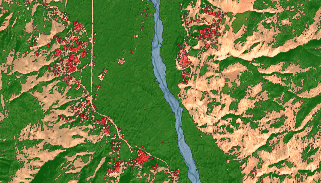 Request Samples
Accurate clutters for RF optimization tools such as planet or Atoll.
Request Samples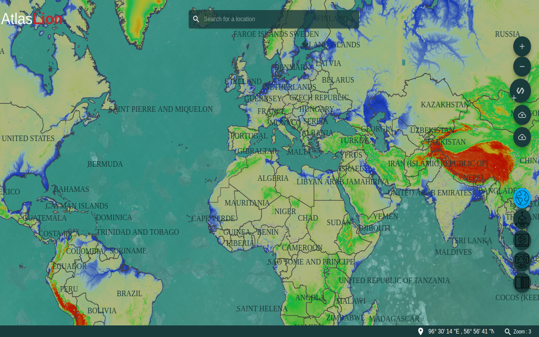 Request Samples
Cross platform app to visualize, compare and share 2D, 3D and 4D data.
Request SamplesWe will get back to you within 24h with differents solutions.
We would gather imagery, process and generate products for you.
We would send you a confirmation mail with link to download your product.
Industrial Zone, Bouskoura
Casablanca
Kingdom Of Morocco
Email: contact@atlasizemzgeospatial.com